[United States] / printed by Rand McNally & Company for free distribution through the newspapers represented by Frederic J. Haskin ; photographs by Harris & Ewing.
- Published/Created:
- Chicago :
Rand, McNally & Co.,
[1920?]. - Physical Description:
- 1 map ; 48 x 69 cm.
- Notes:
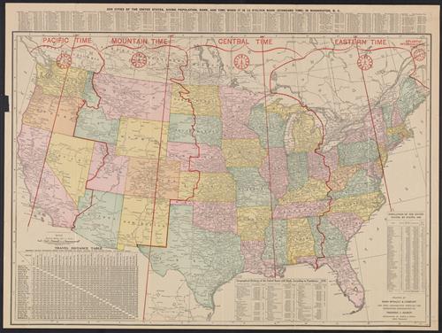
- Various information on borders; shows time zones.
Verso: Central part city of Washington and other data, etc. - Topics:
- United States--Maps
- Language:
- English
- Scale:
- Scale [ca. 1:7,000,000].
- Coordinates:
- a
7000000 - Genre:
- Maps
- Format:
- Map
- Content Type:
- Maps, Atlases & Globes
- Rights:
- The use of this image may be subject to the copyright law of the United States (Title 17, United States Code) or to site license or other rights management terms and conditions. The person using the image is liable for any infringement
- Access Restrictions:
- Public
- Call Number:
- 75 1920
- Folder:
- BRBL_00407A
- Orbis Record:
- 9419366
- Yale Collection:
- Beinecke Library
- Digital Collection:
- Beinecke Rare Book & Manuscript Library
- oid pointer:
- 15829101
- Extent of digitization:
- Complete work digitized.
- OID:
- 15827363
- PID:
- digcoll:4382266