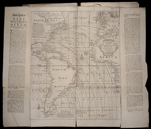
A new and correct chart of the western and southern oceans ...
- Physical Description:
- 1 map
b&w illustration
approximately 66 x 78 cm. folded to 44 x 27 cm. - Topics:
- Navigation --Early works to 1800
Pilot guides --Atlantic Coast (U.S.) --Early works to 1800
Pilot guides --Caribbean Area --Early works to 1800 - Topics:
- Africa --Maps --Early works to 1800
Antarctic Ocean --Maps
Atlantic Ocean --Maps --Early works to 1800
Europe --Maps --Early works to 1800
North America --Maps --Early works to 1800
South America --Maps --Early works to 1800 - Language:
- English
- Genre:
- Engravings
Maps
Maps in books - Format:
- Map
- Content Type:
- Maps, Atlases & Globes
- Rights:
- The use of this image may be subject to the copyright law of the United States (Title 17, United States Code) or to site license or other rights management terms and conditions. The person using the image is liable for any infringement.
- Access Restrictions:
- Public
- Source Creator:
- Mount, John, bookseller
Mount, William, d. 1769, bookseller
Page, Thomas, d. 1733, bookseller - Source Title:
- The English pilot: describing the West-India navigation, from Hudson's-Bay to the river Amazones ... : also a new description of Newfoundland, New-England, New-York, east and west New-Jersey, Dellavar-Bay, Virginia, Maryland, and Carolina, &c. ... : the whole being very much enlarged and corrected, with the additions of several new charts and descriptions : by the information of divers able navigators of our own and other nations
- Source Created:
- London : Printed for W. and J. Mount, T. Page and son, on Tower-Hill, MDCCLIX [1759]
- Call Number:
- 1973 Folio 114
- Orbis Record:
- 3461058
- Yale Collection:
- Beinecke Library
- Digital Collection:
- General Collection, BRBL, Yale University
- oid pointer:
- 1213864
- Volume/Enumeration:
- The fourth book
- Extent of digitization:
- Partial work digitized.
- OID:
- 2046792
- PID:
- digcoll:3551341