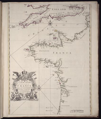
A new chart of the sea coasts of France: together with the English Chanell describing ye severall harbors, sands, rocks, and anchoridges, etc. on the said coasts
- Creator:
- Browne, Christopher, fl. 1684-1712, creator
- Published/Created:
- London
Printed and sold by Chr. Brown at the Globe in St. Pauls Church Yard
[169-?] - Physical Description:
- 1 map
b&w, color illustration
59 x 43.2 cm. on sheet 61.2 x 52 cm. - Notes:
- Bar scales given in English and French leagues and Dutch miles.
No. 6 of 69 maps bound together in composite atlas.
Scale [ca. 1:1 550 000]. - Topics:
- Coasts --England, Southern --Maps --Early works to 1800
Coasts --France, Northern --Maps --Early works to 1800 - Topics:
- England, Southern --Maps --Early works to 1800
English Channel --Maps --Early works to 1800
France, Northern --Maps --Early works to 1800 - Language:
- English
- Genre:
- Atlases
Engravings
Hand coloring
Maps
Maps in books - Format:
- Map
- Content Type:
- Maps, Atlases & Globes
- Rights:
- The use of this image may be subject to the copyright law of the United States (Title 17, United States Code) or to site license or other rights management terms and conditions. The person using the image is liable for any infringement.
- Access Restrictions:
- Public
- Call Number:
- 1973 Folio 10
- Orbis Record:
- 8438114
- Yale Collection:
- Beinecke Library
- Digital Collection:
- General Collection, BRBL, Yale University
- oid pointer:
- 1211210
- Extent of digitization:
- Complete work digitized.
- OID:
- 2046646
- PID:
- digcoll:3549934