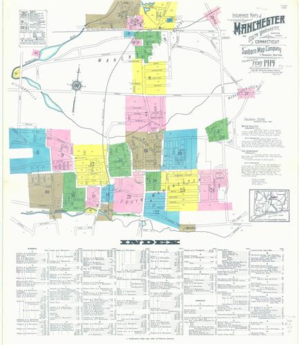
Insurance maps of Manchester and South Manchester, Hartford County, Connecticut.
- Creator:
- Sanborn Map Company, issuing body
- Published/Created:
- 1919
- Purpose:
- The purpose of this dataset is to provide digital archiving of historic, fragile, and otherwise sensitive map documents so that they are not further degraded by continued use by public or private interests. It is also hoped that the digital product will stimulate interest in and use of this valuable resource.
- Physical Description:
- 1 atlas (25 leaves)
64 cm
color - Notes:
- SMLMAPL 766 M31 1919: Sheets disbound. Library of Congress copyright stamp on title sheet.
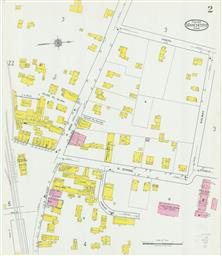
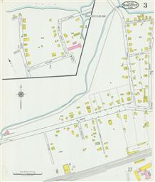
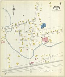
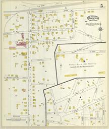
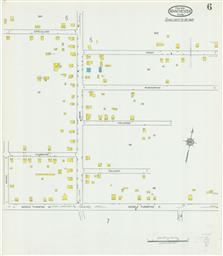
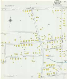
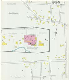
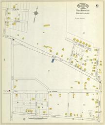
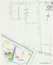
Partial cadastral map.
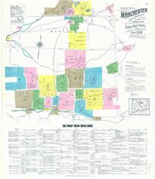
Contains information on population, prevailing winds, water facilities and fire department.
Sheets 2, 15-16, 20 and 25 at scale 1:600 ; sheets 3-14, 17-19 and 21-24 at scale 1:1,200.
"25 sheets. (2582)."
Includes index of streets and specials. - Abstract:
- Sanborn fire insurance maps are a rich source of historic data on the urban built environment of North America during the 19th and early 20th centuries. The atlases were created for the purpose of underwriting fire insurance policies, which depended upon accurate and frequently-updated information about construction materials, municipal and transportation infrastructure, industrial and commercial landuse and more. The Yale University Library Map Department scanned its holdings of Sanborn fire insurance maps (consisting primarily of Connecticut towns) in order to make the maps more accessible.
- Variant Titles:
- Manchester and South Manchester, Hartford County, Connecticut
Feb. 1919, Manchester, Conn. - Topics:
- Fire risk assessment--Connecticut--Manchester--Maps
Fire risk assessment--Connecticut--South Manchester--Maps
Real property--Connecticut--Manchester--Maps
Real property--Connecticut--South Manchester--Maps - Topics:
- Manchester--Maps
South Manchester--Maps - Topics:
- Library of Congress Stamp
- Language:
- English
- Scale:
- Scale 1:600. 50 ft. to an inch.
Scale 1:1,200. 100 ft. to one inch. - Coordinates:
- a
600
1200 - Genre:
- Atlases
Cadastral maps
Connecticut
Fire insurance maps
local
Manchester
South Manchester - Format:
- Map
- Content Type:
- Maps, Atlases & Globes
- Rights:
- The use of this image may be subject to the copyright law of the United States (Title 17, United States Code) or to site license or other rights management terms and conditions. The person using the image is liable for any infringement.
- Access Restrictions:
- Public
- Digital:
- Sanborn
Connecticut
fire insurance maps
transportation (ISO 19115 Topic Categories.)
location (ISO 19115 Topic Categories.)
structure (ISO 19115 Topic Categories.)
utilitiesCommunication (ISO 19115 Topic Categories.) - Call Number:
- 766 M31 1919
- Orbis Record:
- 11783263
- Yale Collection:
- Beinecke Library
- Digital Collection:
- Sanborn Fire Insurance Maps
- oid pointer:
- 11139008
- OID:
- 11139073
- PID:
- digcoll:293444
Number of Pages: 25